Severe Thunderstorm Watch issued April 14 at 5:16PM EDT until April 14 at 11:00PM EDT by NWS Wilmington OH (details ...)
THE NATIONAL WEATHER SERVICE HAS ISSUED SEVERE THUNDERSTORM WATCH 112 IN EFFECT UNTIL 11 PM EDT THIS EVENING FOR THE FOLLOWING AREAS
IN INDIANA THIS WATCH INCLUDES 4 COUNTIES
IN EAST CENTRAL INDIANA
FAYETTE UNION WAYNE
IN SOUTHEAST INDIANA
FRANKLIN
IN OHIO THIS WATCH INCLUDES 7 COUNTIES
IN WEST CENTRAL OHIO
AUGLAIZE DARKE MERCER MIAMI MONTGOMERY PREBLE SHELBY
THIS INCLUDES THE CITIES OF BROOKVILLE, CAMDEN, CELINA, COLDWATER, CONNERSVILLE, DOWNTOWN DAYTON, EATON, GREENVILLE, KETTERING, LIBERTY, MINSTER, NEW BREMEN, PIQUA, RICHMOND, SIDNEY, ST. MARYS, TIPP CITY, TROY, WAPAKONETA, AND WEST COLLEGE CORNER.
Today 82° Today 82° chance 67° 67° chance Tomorrow 83° Tomorrow 83° likely 66° 66° likely
Tuesday, April 14th, 2026
Weather talk
Photo by Jerry Martin/The Daily Standard

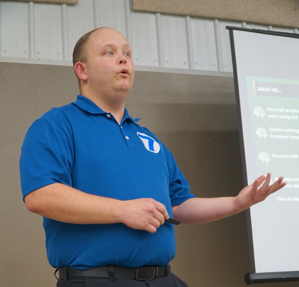
Meteorologist Nick Dunn of WHIO's Stormcenter7 dropped by the PBS Building at the Mercer County Fairgrounds in Celina Monday night to deliver a talk on severe weather and how to stay ahead of it. Over 30 people attended the class to learn about useful weather apps and resources, severe storms, forecasting, weather terminology and more. The event was sponsored by the Shelby and Mercer county EMAs.

Additional pictures on this date