Fort Recovery Tornado

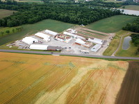
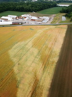
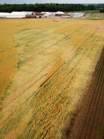
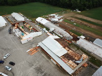
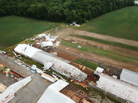
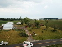
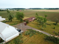
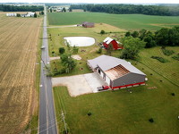
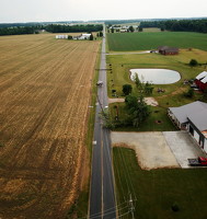
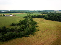
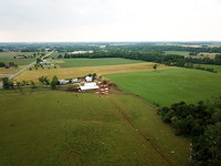
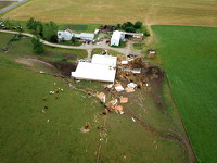
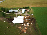
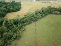
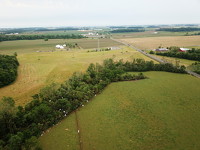
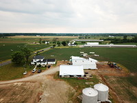
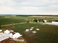
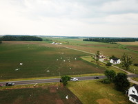
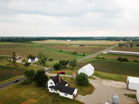
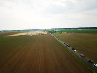
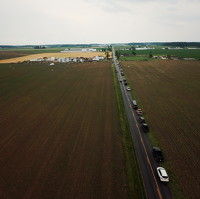
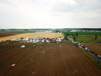
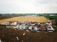
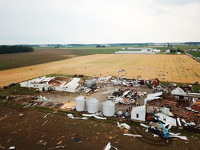
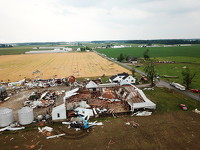
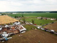
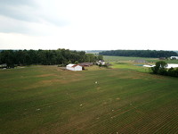
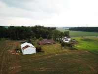
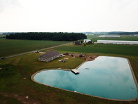
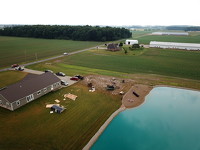
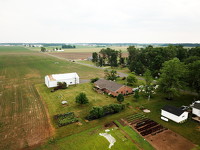
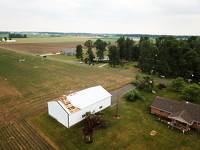
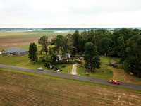
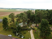
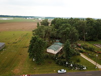
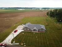
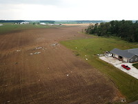
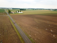
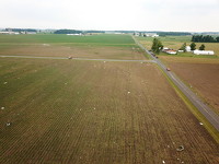
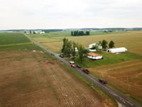
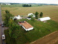
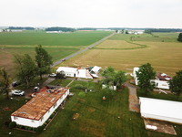
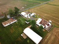
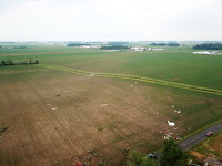
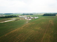
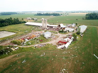
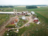
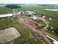
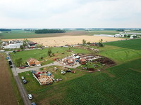
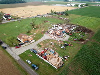
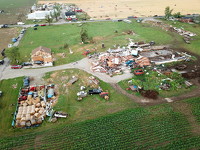
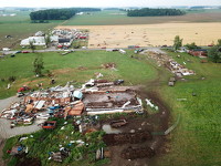
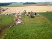
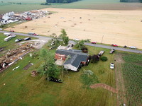
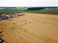
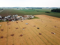
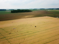
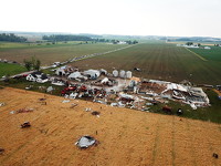
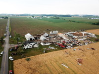
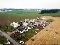
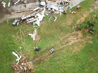
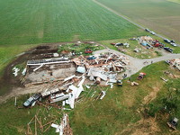
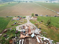
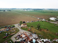
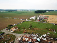
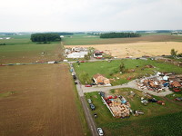
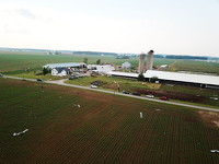
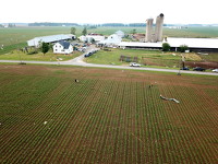
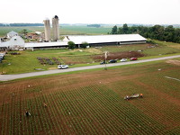
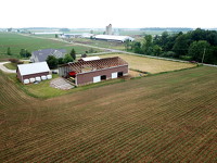
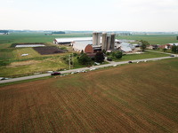
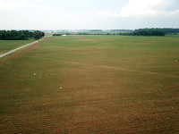
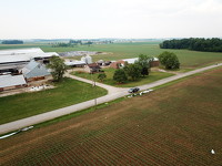
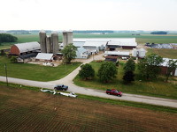
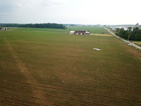
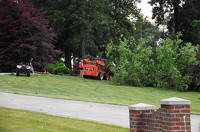
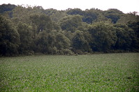
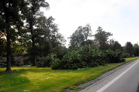
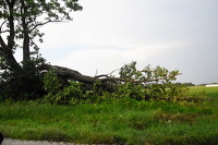
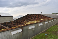
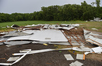
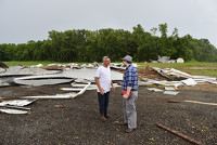
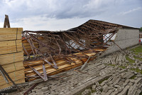
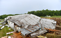
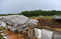
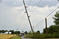
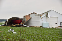
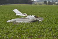
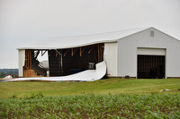
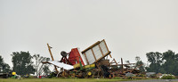
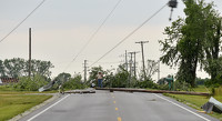
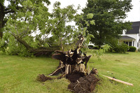
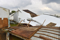
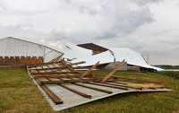
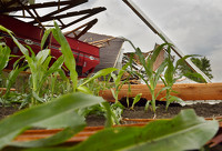
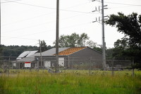
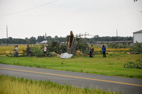
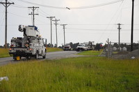
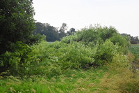
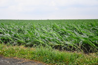
On Friday afternoon a tornado passed near Fort Recovery starting near Indiana, passing just north of the village and continuing to the southeast intersecting Fort Recovery-Minster, Burrville and Fox Roads, among others. There were no injuries. Photos by Ryan Snyder, Dan Melograna and Jason Snyder.

Read the full story and view some pictures on a map.

96 of 103 pictures
Friday, June 18th, 2021
Photo by Daily Standard Staff
Winter Weather Advisory issued December 13 at 9:00AM EST until December 14 at 7:00AM EST by NWS Wilmington OH (details ...)
* WHAT...Snow expected. Total snow accumulations between 3 and 5 inches.
* WHERE...Portions of central and west central Ohio.
* WHEN...From 1 PM this afternoon to 7 AM EST Sunday.
* IMPACTS...Plan on slippery road conditions.
Cold Weather Advisory issued December 13 at 2:21AM EST until December 15 at 11:00AM EST by NWS Wilmington OH (details ...)
* WHAT...Very cold wind chills as low as 10 to 15 below zero expected.
* WHERE...Portions of east central and southeast Indiana, northeast and northern Kentucky, and central, south central, southwest, and west central Ohio.
* WHEN...From 7 PM this evening to 11 AM EST Monday.
* IMPACTS...The cold wind chills as low as 15 below zero could result in hypothermia or frostbite if precautions are not taken.
Today 27° Today 27° Tomorrow 16° Tomorrow 16°
thum pict
thum pict
thum pict
thum pict
thum pict
thum pict
thum pict
thum pict
thum pict
thum pict
thum pict
thum pict
thum pict
thum pict
thum pict
thum pict
thum pict
thum pict
thum pict
thum pict
thum pict
thum pict
thum pict
thum pict
thum pict
thum pict
thum pict
thum pict
thum pict
thum pict
thum pict
thum pict
thum pict
thum pict
thum pict
thum pict
thum pict
thum pict
thum pict
thum pict
thum pict
thum pict
thum pict
thum pict
thum pict
thum pict
thum pict
thum pict
thum pict
thum pict
thum pict
thum pict
thum pict
thum pict
thum pict
thum pict
thum pict
thum pict
thum pict
thum pict
thum pict
thum pict
thum pict
thum pict
thum pict
thum pict
thum pict
thum pict
thum pict
thum pict
thum pict
thum pict
thum pict
thum pict
thum pict
thum pict
thum pict
thum pict
thum pict
thum pict
thum pict
thum pict
thum pict
thum pict
thum pict
thum pict
thum pict
thum pict
thum pict
thum pict
thum pict
thum pict
thum pict
thum pict
thum pict
thum pict
thum pict
thum pict
thum pict
thum pict
thum pict
thum pict
thum pict