Weather Observations near Celina (12:01 pm)
Weather Forecast for the Grand Lake area
Wind direction arrow points in direction wind is
blowing toward. Example: wind is blowing
from southwest to northeast.
Saturday
August 1
| avg high: |
82.5°F |
| avg low: |
63.0°F |
| rec. high: |
95, 2002 |
| rec. low: |
49, 1962 |
| Sunrise: |
6:34 am |
| Sunset: |
8:55 pm |
| Moonrise: |
9:25 pm |
| Moonset: |
8:35 am |
Sunday
August 2
| avg high: |
82.5°F |
| avg low: |
62.9°F |
| rec. high: |
95, 1964 |
| rec. low: |
50, 1976 |
| Sunrise: |
6:35 am |
| Sunset: |
8:53 pm |
| Moonrise: |
9:46 pm |
| Moonset: |
9:40 am |
Monday
August 3
| avg high: |
82.4°F |
| avg low: |
62.9°F |
| rec. high: |
101, 1897 |
| rec. low: |
44, 1965 |
| Sunrise: |
6:36 am |
| Sunset: |
8:52 pm |
| Moonrise: |
10:09 pm |
| Moonset: |
10:47 am |
Tuesday
August 4
| avg high: |
82.4°F |
| avg low: |
62.8°F |
| rec. high: |
94, 2002 |
| rec. low: |
48, 1966 |
| Sunrise: |
6:37 am |
| Sunset: |
8:51 pm |
| Moonrise: |
10:34 pm |
| Moonset: |
11:56 am |
Wednesday
August 5
| avg high: |
82.4°F |
| avg low: |
62.8°F |
| rec. high: |
95, 1956 |
| rec. low: |
45, 1972 |
| Sunrise: |
6:38 am |
| Sunset: |
8:50 pm |
| Moonrise: |
11:06 pm |
| Moonset: |
1:09 pm |
| Third Quarter Moon: |
10:21 pm |
Thursday
August 6
| avg high: |
82.3°F |
| avg low: |
62.7°F |
| rec. high: |
93, 1965 |
| rec. low: |
44, 1994 |
| Sunrise: |
6:39 am |
| Sunset: |
8:49 pm |
| Moonrise: |
11:45 pm |
| Moonset: |
2:24 pm |
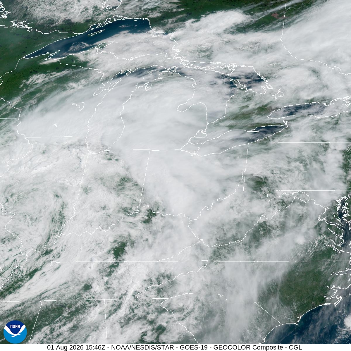
Midwest US from Satellite
11:46 am, Aug 1
(Tap or click to animate.)
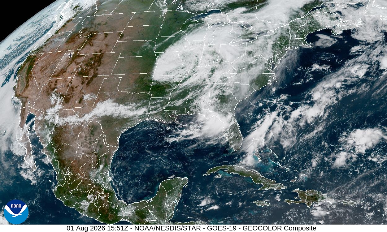
Contiguous US from Satellite
11:51 am, Aug 1
(Tap or click to animate.)
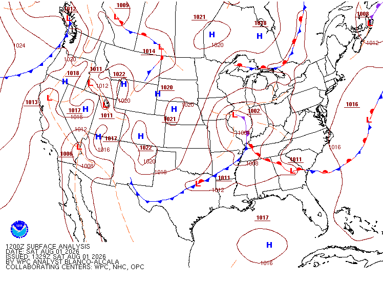
US Weather Map
9:32 am, Aug 1
(Tap or click to animate.)
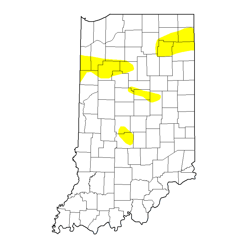
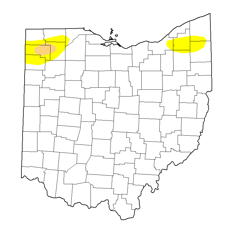
Drought Maps
July 28, 2026
(Tap or click to animate.)
Copyright © 2026 Standard Printing Co. All Rights Reserved