Severe Thunderstorm Warning issued March 22 at 8:23PM EDT until March 22 at 9:00PM EDT by NWS Wilmington OH (details ...)
SVRILN
The National Weather Service in Wilmington has issued a
* Severe Thunderstorm Warning for... Northern Darke County in west central Ohio... Western Auglaize County in west central Ohio... Mercer County in west central Ohio...
* Until 900 PM EDT.
* At 822 PM EDT, severe thunderstorms were located along a line extending from near Monroe to Redkey, moving east at 50 mph.
HAZARD...60 mph wind gusts and quarter size hail.
SOURCE...Radar indicated.
IMPACT...Minor hail damage to vehicles is possible. Expect wind damage to trees and power lines.
* Locations impacted include... Celina, St. Marys, Coldwater, St. Henry, Fort Recovery, Rockford, Wabash, Mendon, Osgood, Chickasaw, Burkettsville, North Star, Montezuma, New Weston, Yorkshire, Chattanooga, Kossuth, Tama, North Dayton, and Maria Stein.
Severe Thunderstorm Watch issued March 22 at 5:43PM EDT until March 23 at 12:00AM EDT by NWS Wilmington OH (details ...)
THE NATIONAL WEATHER SERVICE HAS ISSUED SEVERE THUNDERSTORM WATCH 73 IN EFFECT UNTIL MIDNIGHT EDT TONIGHT FOR THE FOLLOWING AREAS
IN INDIANA THIS WATCH INCLUDES 8 COUNTIES
IN EAST CENTRAL INDIANA
FAYETTE UNION WAYNE
IN SOUTHEAST INDIANA
DEARBORN FRANKLIN OHIO RIPLEY SWITZERLAND
IN KENTUCKY THIS WATCH INCLUDES 3 COUNTIES
IN NORTHERN KENTUCKY
BOONE CAMPBELL KENTON
IN OHIO THIS WATCH INCLUDES 32 COUNTIES
IN CENTRAL OHIO
DELAWARE FAIRFIELD FAYETTE FRANKLIN HOCKING LICKING MADISON PICKAWAY UNION
IN SOUTH CENTRAL OHIO
ADAMS HIGHLAND PIKE ROSS SCIOTO
IN SOUTHWEST OHIO
BROWN BUTLER CLERMONT CLINTON HAMILTON WARREN
IN WEST CENTRAL OHIO
AUGLAIZE CHAMPAIGN CLARK DARKE GREENE HARDIN LOGAN MERCER MIAMI MONTGOMERY PREBLE SHELBY
THIS INCLUDES THE CITIES OF ABERDEEN, ADA, ALEXANDRIA, AURORA, BATESVILLE, BEAVERCREEK, BELLEFONTAINE, BELLEVUE, BLANCHESTER, BRIGHT, BROOKVILLE, BURLINGTON, CAMDEN, CELINA, CHILLICOTHE, CIRCLEVILLE, COLDWATER, CONNERSVILLE, COVINGTON, DAY HEIGHTS, DAYTON, DELAWARE, DILLSBORO, DOWNTOWN CINCINNATI, DOWNTOWN COLUMBUS, DOWNTOWN DAYTON, EATON, ERLANGER, FAIRBORN, FAIRFIELD, FLORENCE, FORT THOMAS, FRANKLIN, GEORGETOWN, GREENDALE, GREENFIELD, GREENVILLE, HAMILTON, HIDDEN VALLEY, HIGHLAND HEIGHTS, HILLSBORO, INDEPENDENCE, KENTON, KETTERING, LANCASTER, LANDEN, LAWRENCEBURG, LEBANON, LIBERTY, LOGAN, LONDON, MANCHESTER, MARYSVILLE, MASON, MIDDLETOWN, MILAN, MILFORD, MINSTER, MOUNT CARMEL, MOUNT ORAB, MOUNT REPOSE, MULBERRY, NEW BREMEN, NEWARK, NEWPORT, OAKBROOK, OSGOOD, OXFORD, PEEBLES, PICKERINGTON, PIKE LAKE, PIKETON, PIQUA, PLAIN CITY, PORTSMOUTH, RICHMOND, RIPLEY, RISING SUN, SEAMAN, SIDNEY, SPRINGBORO, SPRINGFIELD, ST. MARYS, SUMMERSIDE, TIPP CITY, TROY, URBANA, VERSAILLES, VEVAY, WAPAKONETA, WASHINGTON COURT HOUSE, WAVERLY, WEST COLLEGE CORNER, WEST JEFFERSON, WEST UNION, WHEELERSBURG, WILMINGTON, WINCHESTER, WITHAMSVILLE, AND XENIA.
Severe Thunderstorm Warning issued March 22 at 8:26PM EDT until March 22 at 9:00PM EDT by NWS Wilmington OH (details ...)
At 826 PM EDT, severe thunderstorms were located along a line extending from near Ada to near Lakeview, moving east at 60 mph.
HAZARD...Half dollar size hail.
SOURCE...Broadcast media.
IMPACT...Minor damage to vehicles is possible.
Locations impacted include... Kenton, Ada, Forest, Lakeview, Dunkirk, Alger, Waynesfield, Belle Center, Chippewa Park, Blanchard, Roundhead, Mount Victory, Mcguffey, Ridgeway, Patterson, Dola, Huntersville, Pfeiffer, Big Springs, and State Route 195 at State Route 235.
32° 32° Mon 47° Mon 47° 29° 29° Tue 53° Tue 53°
Saturday, September 27th, 2025
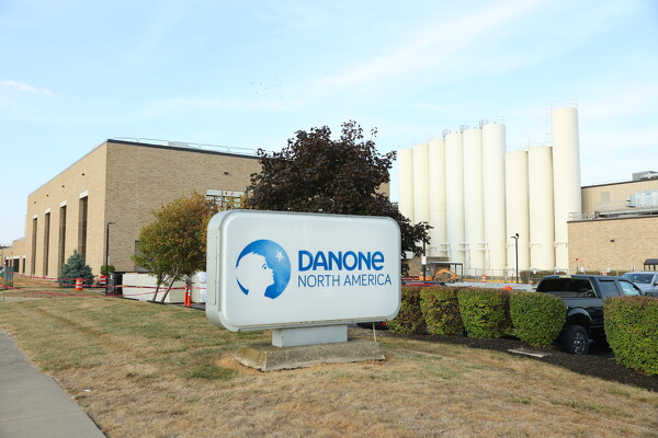
New Minster plant should benefit Danone, village
By Tom Millhouse
MINSTER - A New England company is bringing new energy technology to Minster which would help fuel a planned multimillion expansion at the local Danone yogurt plant.
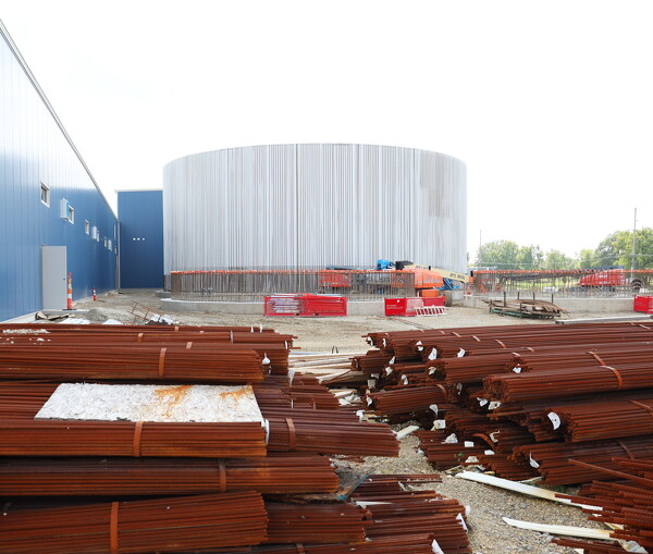
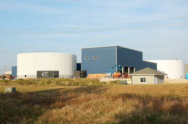
PurposeEnergy, headquartered in Windham, New Hampshire, is building an anaerobic digester facility on Columbia Drive in the Route 66 Industrial Park to treat organic residual food production waste from the Danone yogurt plant located across State Route 66. [More]
By Joe Schatz
CELINA - After starting the season struggling on offense, Celina's record-setting 70-35 win over Kenton was like a relief of epic proportions.
It is not only the most points scored in Celina football history, but Parker Bertke's five touchdown performance ties a school record shared by Jim Otis and Braylon Gabes. Bertke finished the night with 177 yards on 16 carries, better than 11 yards-per-carry. [More]
Obituaries on September 27th, 2025
Joseph Henry Dues, age 75, of rural Portland, passed away with his family at hi [More]
Joseph L. Mescher, age 80 of St. Henry, passed away on Thursday, September 25, [More]
Robert U. Link, age 95, of Celina, passed away on Friday, Sept. 26, 2025, at Th [More]
Local pictures on September 27th, 2025
Subscriber stories on September 27th, 2025
CELINA - A 70-year-old Celina man who is currently 18 years into a 20-year sentence for child sex crimes was sentenced to additional time in prison on Friday in Mercer County Common Pleas Court for separate child sex crimes he committed over 20 years ago.
WAPAKONETA - The Auglaize County Health Department is set to hold its annual drive-thru flu clinic next month at the county fairgrounds in Wapakoneta
Marion Local rallies to defeat Versailles and stay unbeaten
MARIA STEIN - A 70-game winning streak can produce a lot of forgettable games.
Friday night at Booster Stadium wasn't one of them.
Marion Local
FORT RECOVERY - New Bremen had the football in Fort Recovery territory many times Friday night.
But the Cardinals had a tough time scoring.
The I
MINSTER - The St. Henry Redskins arrived in Minster on Senior Night for the Wildcats, and dampened the festivities by dominating in every phase of the game for a 45-0 victory at Memorial Field.
Compiled by Gary R. Rasberry
Coldwater compiled a school-record 583 yards of total offense and held a 43-13 halftime lead en route to beating Parkway 63-19 in Midwest Athletic Conference play on Friday night at Panther Stadium in Rockford, moving to 4-2 on the season and 3-1 in MAC play.