Severe Thunderstorm Watch issued April 27 at 11:27PM EDT until April 28 at 4:00AM EDT by NWS Wilmington OH (details ...)
SEVERE THUNDERSTORM WATCH 165 REMAINS VALID UNTIL 4 AM EDT TUESDAY FOR THE FOLLOWING AREAS
IN INDIANA THIS WATCH INCLUDES 8 COUNTIES
IN EAST CENTRAL INDIANA
FAYETTE UNION WAYNE
IN SOUTHEAST INDIANA
DEARBORN FRANKLIN OHIO RIPLEY SWITZERLAND
IN KENTUCKY THIS WATCH INCLUDES 10 COUNTIES
IN NORTHERN KENTUCKY
BOONE BRACKEN CAMPBELL CARROLL GALLATIN GRANT KENTON OWEN PENDLETON ROBERTSON
IN OHIO THIS WATCH INCLUDES 6 COUNTIES
IN SOUTHWEST OHIO
BUTLER CLERMONT HAMILTON
IN WEST CENTRAL OHIO
DARKE MERCER PREBLE
THIS INCLUDES THE CITIES OF ALEXANDRIA, AUGUSTA, AURORA, BATESVILLE, BELLEVUE, BRIGHT, BROOKSVILLE, BROOKVILLE, BURLINGTON, BUTLER, CAMDEN, CARROLLTON, CELINA, COLDWATER, CONNERSVILLE, COVINGTON, CRITTENDEN, DAY HEIGHTS, DAYTON, DILLSBORO, DOWNTOWN CINCINNATI, DRY RIDGE, EATON, ERLANGER, FAIRFIELD, FALMOUTH, FLORENCE, FORT THOMAS, GREENDALE, GREENVILLE, HAMILTON, HIDDEN VALLEY, HIGHLAND HEIGHTS, INDEPENDENCE, LAWRENCEBURG, LIBERTY, MIDDLETOWN, MILAN, MILFORD, MOUNT CARMEL, MOUNT OLIVET, MOUNT REPOSE, MULBERRY, NEWPORT, OAKBROOK, OSGOOD, OWENTON, OXFORD, RICHMOND, RISING SUN, SUMMERSIDE, VERSAILLES, VEVAY, WARSAW, WEST COLLEGE CORNER, WILLIAMSTOWN, AND WITHAMSVILLE.
Special Weather Statement issued April 27 at 11:00PM EDT by NWS Wilmington OH (details ...)
Wind gusts of 35 to 50 MPH will be possible over the next few hours. These winds will occur separately from any thunderstorms. Winds of this magnitude may damage small tree limbs and make driving difficult, especially for high profile vehicles.
Severe Thunderstorm Warning issued April 27 at 11:56PM EDT until April 28 at 1:00AM EDT by NWS Wilmington OH (details ...)
SVRILN
The National Weather Service in Wilmington has issued a
* Severe Thunderstorm Warning for... Eastern Wayne County in east central Indiana... Western Shelby County in west central Ohio... Northern Preble County in west central Ohio... Darke County in west central Ohio... Northwestern Montgomery County in west central Ohio... Southwestern Auglaize County in west central Ohio... Western Miami County in west central Ohio...
* Until 100 AM EDT.
* At 1156 PM EDT, severe thunderstorms were located along a line extending from near Winchester to Glenwood, moving east at 50 mph.
HAZARD...60 mph wind gusts.
SOURCE...Radar indicated.
IMPACT...Expect damage to trees and power lines.
* Locations impacted include... Richmond, Trotwood, Piqua, Englewood, Greenville, Eaton, West Milton, New Bremen, Minster, Versailles, Covington, Arcanum, Newport, Bradford, Lewisburg, New Paris, Fort Loramie, West Alexandria, Pleasant Hill, and Ansonia.
This includes the following Interstates... I-70 in Indiana between mile markers 149 and 156. I-70 in Ohio between mile markers 0 and 26.
Severe Thunderstorm Watch issued April 27 at 11:27PM EDT until April 28 at 4:00AM EDT by NWS Wilmington OH (details ...)
THE NATIONAL WEATHER SERVICE HAS EXTENDED SEVERE THUNDERSTORM WATCH 165 TO INCLUDE THE FOLLOWING AREAS UNTIL 4 AM EDT TUESDAY
IN OHIO THIS WATCH INCLUDES 5 COUNTIES
IN SOUTHWEST OHIO
WARREN
IN WEST CENTRAL OHIO
AUGLAIZE MIAMI MONTGOMERY SHELBY
THIS INCLUDES THE CITIES OF DOWNTOWN DAYTON, FRANKLIN, KETTERING, LANDEN, LEBANON, MASON, MINSTER, NEW BREMEN, PIQUA, SIDNEY, SPRINGBORO, ST. MARYS, TIPP CITY, TROY, AND WAPAKONETA.
61° 61° Tue 72° Tue 72° chance 50° 50° likely Wed 60° Wed 60° likely
Friday, March 22nd, 2024
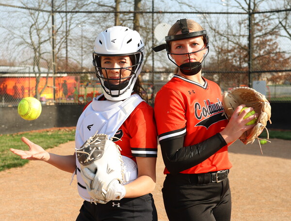
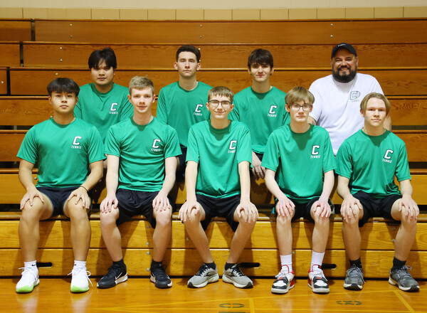
The Last Pitch
Photo by Paige Sutter/The Daily Standard

The cover of the Spring Sports Preview.

Additional pictures on this date