Flood Warning issued September 20 at 5:21PM EDT until September 21 at 8:00AM EDT by NWS Wilmington OH (details ...)
...The Flood Warning continues for the following rivers...
St. Marys River at Rockford.
* WHAT...Minor flooding is forecast.
* WHERE...St. Marys River at Rockford.
* WHEN...Until Monday morning.
* IMPACTS...At 13.0 feet, State Route 117 near Route 118 north of Rockford is water-covered and closed.
* ADDITIONAL DETAILS... - At 4:40 PM EDT Sunday the stage was 12.9 feet. - Forecast...The river is expected to rise to a crest of 13.0 feet this evening. It will then fall below flood stage just after midnight tonight. - Flood stage is 13.0 feet.
Flood Watch issued September 20 at 1:07PM EDT until September 21 at 8:00AM EDT by NWS Wilmington OH (details ...)
* WHAT...Flash flooding caused by excessive rainfall is possible.
* WHERE...Portions of Indiana, including the following counties, Dearborn, Fayette, Franklin, Ripley, Union and Wayne and Ohio, including the following counties, Adams, Auglaize, Brown, Butler, Champaign, Clark, Clermont, Clinton, Darke, Delaware, Fairfield, Fayette, Franklin, Greene, Hamilton, Hardin, Highland, Hocking, Licking, Logan, Madison, Mercer, Miami, Montgomery, Pickaway, Pike, Preble, Ross, Scioto, Shelby, Union and Warren.
* WHEN...From 7 PM EDT this evening through Monday morning.
* IMPACTS...Excessive runoff may result in flooding of rivers, creeks, streams, and other low-lying and flood-prone locations.
* ADDITIONAL DETAILS... - Showers and thunderstorms producing heavy rain will impact the area overnight. Rainfall totals of 1 to 3 inches are expected with locally higher amounts. The heavy rain combined with saturated ground will lead to potential flash flooding.
Today 80° Today 80° chance 61° 61° likely Tomorrow 66° Tomorrow 66° chance 58° 58° slight chance
Monday, January 14th, 2008

Share your stories of the blizzard of '78

By Daily Standard Staff
This month marks the 30th anniversary of the blizzard of 1978 - the greatest snowstorm on record to hit the Midwest.
The Daily Standard plans to recap the havoc Mother Nature played on the Grand Lake area in 1978 and is seeking input from readers. If you have interesting stories and vivid memories of the blizzard that you'd like to share, please send them our way.
Good quality photographs also are welcome.
All information and photographs can be sent via e-mail to sgrieshop@dailystandard.com or by U.S. mail to: The Daily Standard, c/o Shelley Grieshop, 123 E. Market St., P.O. Box 140, Celina, OH 45822.
Please include your name and phone number. Deadline to submit information is Jan. 23.

Additional online stories on this date
FORT RECOVERY - If it were up to school Superintendent David Riel, there would be no valedictorians or salutatorians named every year.
During the F [More]
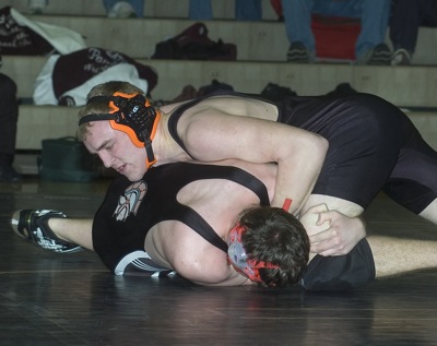
COLDWATER - Facing off against some solid teams, the Coldwater wrestling team had a big challenge in trying to go unbeaten during Saturday's Coldwater Duals Tournament in The Palace. [More]
Subscriber and paid stories on this date
The Wabash River Conservancy District made bonus payments on nine separate filter strips along the river totaling 24 acres in 2007.
The information
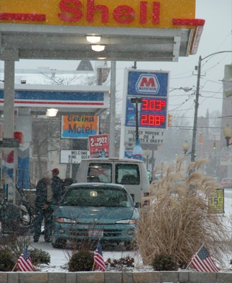
Gasoline prices continue to stay around $3 per gallon locally despite earlier predictions that motorists would face at least $4 at the pumps during the holidays.
The Mercer County Sheriff's Office honored some of its own during an annual breakfast meeting held Saturday morning at the Mercer County Fairgrounds.
Lt. Martin Emerine was surprised as he received the employee of the year honors based on nominations from employees.
Compiled by Gary R. Rasberry and Randy Bruns
After a slight slump took his average under double digits, Derik Snyder came out with a vengeance on Saturday, helping Parkway down Temple Christian 66-57 on Saturday at Panther Gymnasium.
Compiled by Gary R. Rasberry
Celina got its turn to host its annual Celina-Wapak Invitational on Saturday at the Mercer County Family Y outside Celina. The past several years, the Wapakoneta YMCA plays host to the event that brings in a number of area teams.